


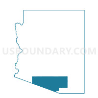
Voting District 285, Pima County, Arizona
About
Outline

Summary
| Unique Area Identifier | 525504 |
| Name | Voting District 285 |
| County | Pima County |
| State | Arizona |
| Area (square miles) | 109.27 |
| Land Area (square miles) | 109.27 |
| Water Area (square miles) | 0.00 |
| % of Land Area | 100.00 |
| % of Water Area | 0.00 |
| Latitude of the Internal Point | 32.42649670 |
| Longtitude of the Internal Point | -110.82580840 |
Maps


Graphs
Select a template below for downloading or customizing gragh for Voting District 285, Pima County, Arizona


Neighbors
Neighoring Voting District (by Name) Neighboring Voting District on the Map
- Voting District 13, Pima County, AZ
- Voting District 188, Pima County, AZ
- Voting District 220, Pima County, AZ
- Voting District 240, Pima County, AZ
- Voting District 266, Pima County, AZ
- Voting District 267, Pima County, AZ
- Voting District 268, Pima County, AZ
- Voting District 280, Pima County, AZ
- Voting District 283, Pima County, AZ
- Voting District 302, Pima County, AZ
- Voting District 346, Pima County, AZ
- Voting District 347, Pima County, AZ
- Voting District 363, Pima County, AZ
- Voting District 365, Pima County, AZ
- Voting District 369, Pima County, AZ
- Oracle Voting District, Pinal County, AZ
- Picacho Peak Voting District, Pinal County, AZ
- San Manuel Voting District, Pinal County, AZ
Top 10 Neighboring County Subdivision (by Population) Neighboring County Subdivision on the Map
Top 10 Neighboring Place (by Population) Neighboring Place on the Map
- Catalina Foothills CDP, AZ (50,796)
- Oro Valley town, AZ (41,011)
- Saddlebrooke CDP, AZ (9,614)
- Catalina CDP, AZ (7,569)
- Summerhaven CDP, AZ (40)
Top 10 Neighboring Elementary School District (by Population) Neighboring Elementary School District on the Map
Top 10 Neighboring Unified School District (by Population) Neighboring Unified School District on the Map
- Tucson Unified District, AZ (472,675)
- Amphitheater Unified District, AZ (136,207)
- School District Not Defined, AZ (69,809)
- Catalina Foothills Unified District, AZ (31,188)
- Mammoth-San Manuel Unified District, AZ (5,460)
Top 10 Neighboring State Legislative District Lower Chamber (by Population) Neighboring State Legislative District Lower Chamber on the Map
- State House District 23, AZ (370,479)
- State House District 30, AZ (231,236)
- State House District 26, AZ (195,881)
Top 10 Neighboring State Legislative District Upper Chamber (by Population) Neighboring State Legislative District Upper Chamber on the Map
- State Senate District 23, AZ (370,479)
- State Senate District 30, AZ (231,236)
- State Senate District 26, AZ (195,881)
Top 10 Neighboring 111th Congressional District (by Population) Neighboring 111th Congressional District on the Map
Top 10 Neighboring Census Tract (by Population) Neighboring Census Tract on the Map
- Census Tract 47.19, Pima County, AZ (5,700)
- Census Tract 47.14, Pima County, AZ (5,611)
- Census Tract 47.16, Pima County, AZ (5,464)
- Census Tract 22, Pinal County, AZ (5,250)
- Census Tract 6.04, Pinal County, AZ (4,681)
- Census Tract 47.13, Pima County, AZ (3,776)
- Census Tract 47.17, Pima County, AZ (2,019)
- Census Tract 24, Pinal County, AZ (1,997)
- Census Tract 40.52, Pima County, AZ (1,944)
Top 10 Neighboring 5-Digit ZIP Code Tabulation Area (by Population) Neighboring 5-Digit ZIP Code Tabulation Area on the Map
- 85704, AZ (30,929)
- 85718, AZ (27,367)
- 85750, AZ (24,161)
- 85737, AZ (20,727)
- 85739, AZ (17,848)
- 85602, AZ (9,464)
- 85623, AZ (4,073)
- 85631, AZ (3,630)
- 85619, AZ (50)